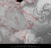
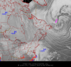
We`re going to start working on producing satellite imagery for the website. We want to make this our niche offering where people come to the site to view our cool new satellite images. These will be unique to Canada.
There will be no tiny thumbnail size images where you need glasses to view them, these will be something to sink your teeth into. We will probably offer east, central and west coast images in what is becoming the standard 800×600 size and if we can get the data feeds, the Canadian Arctic too.
In time, we would like to expand these into a higher resolution size much like our surface plots charts which display at 1500x1200px. Awesome for storm chasing where you can get close up.
I may try and post a few sample images here this week, so keep checking in They will probably run every hour initially while we monitor server load then we hope to run them every 30 minutes.
Attached thumbnail(s)